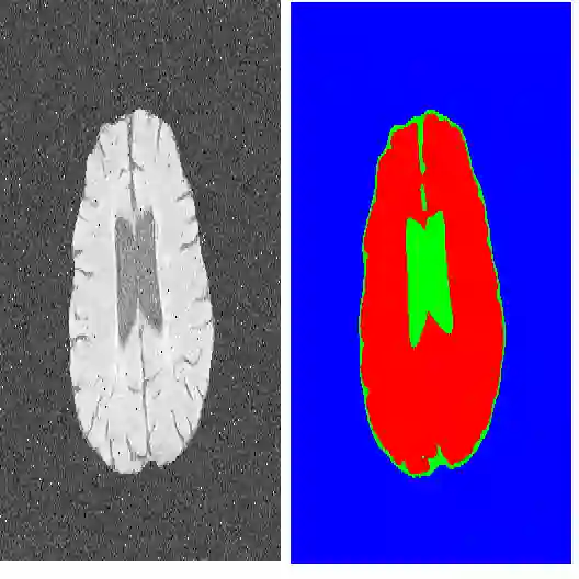
The geodesic model based on the eikonal partial differential equation (PDE) has served as a fundamental tool for the applications of image segmentation and boundary detection in the past two decades. However, the existing approaches commonly only exploit the image edge-based features for computing minimal geodesic paths, potentially limiting their performance in complicated segmentation situations. In this paper, we introduce a new variational image segmentation model based on the minimal geodesic path framework and the eikonal PDE, where the region-based appearance term that defines then regional homogeneity features can be taken into account for estimating the associated minimal geodesic paths. This is done by constructing a Randers geodesic metric interpretation of the region-based active contour energy functional. As a result, the minimization of the active contour energy functional is transformed into finding the solution to the Randers eikonal PDE. We also suggest a practical interactive image segmentation strategy, where the target boundary can be delineated by the concatenation of several piecewise geodesic paths. We invoke the Finsler variant of the fast marching method to estimate the geodesic distance map, yielding an efficient implementation of the proposed region-based Randers geodesic model for image segmentation. Experimental results on both synthetic and real images exhibit that our model indeed achieves encouraging segmentation performance.
翻译:基于程函偏微分方程(PDE)的测地线模型在过去二十年中已成为图像分割和边界检测应用的基础工具。然而,现有方法通常仅利用基于图像边缘的特征来计算最小测地线路径,这在复杂分割场景中可能限制其性能。本文提出一种基于最小测地线路径框架与程函PDE的新型变分图像分割模型,该模型通过引入定义区域同质特征的区域外观项来估计相关的测地线路径。具体而言,我们构建了区域活动轮廓能量泛函的Randers测地线度量解释,从而将活动轮廓能量泛函的最小化问题转化为求解Randers程函PDE。此外,我们提出一种实用的交互式图像分割策略,通过拼接若干分段测地线路径勾勒目标边界。通过采用快速行进法的Finsler变体估计测地线距离图,实现了所提出的基于区域Randers测地线模型的高效图像分割。在合成图像与真实图像上的实验结果表明,该模型确实取得了令人鼓舞的分割性能。