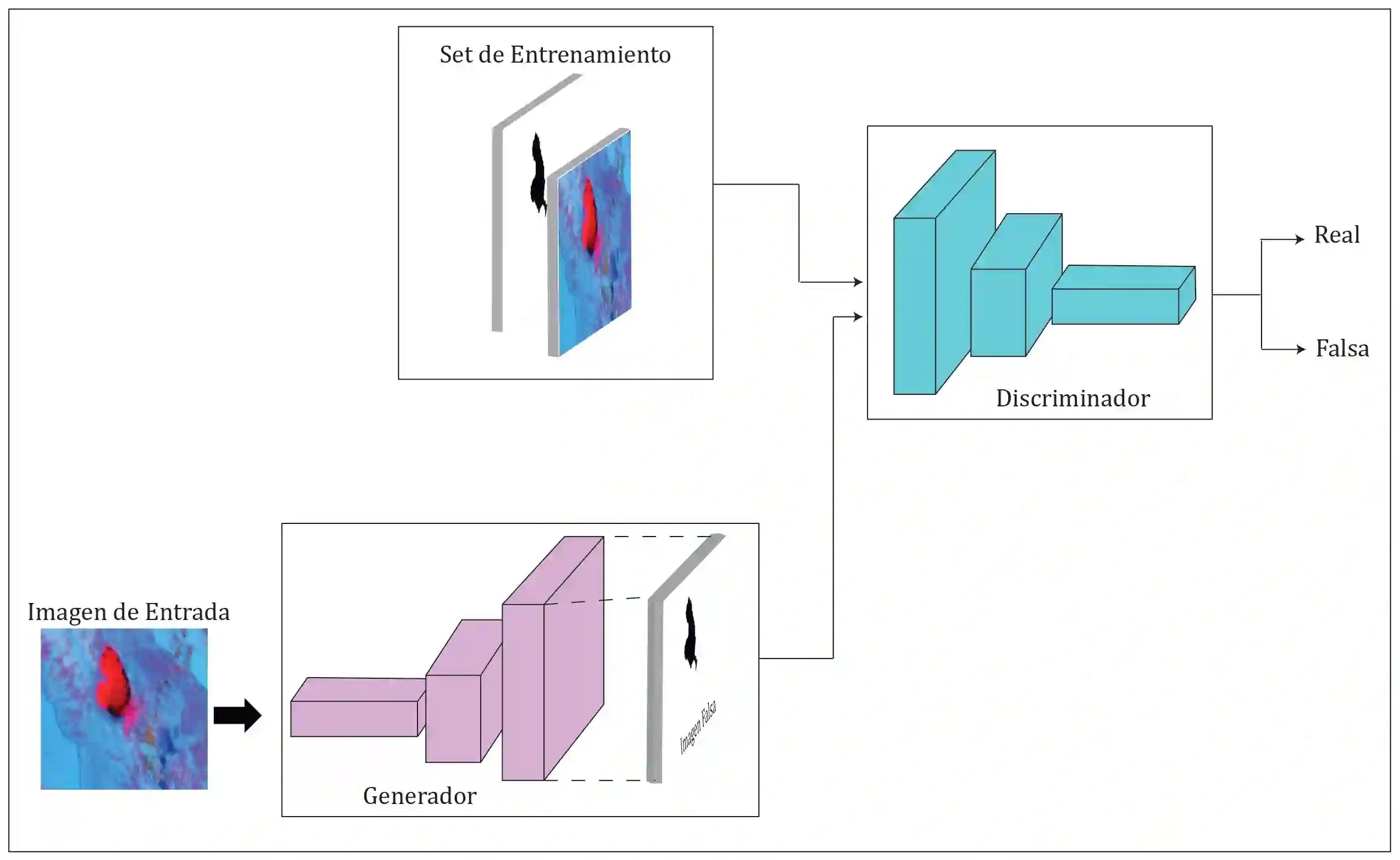
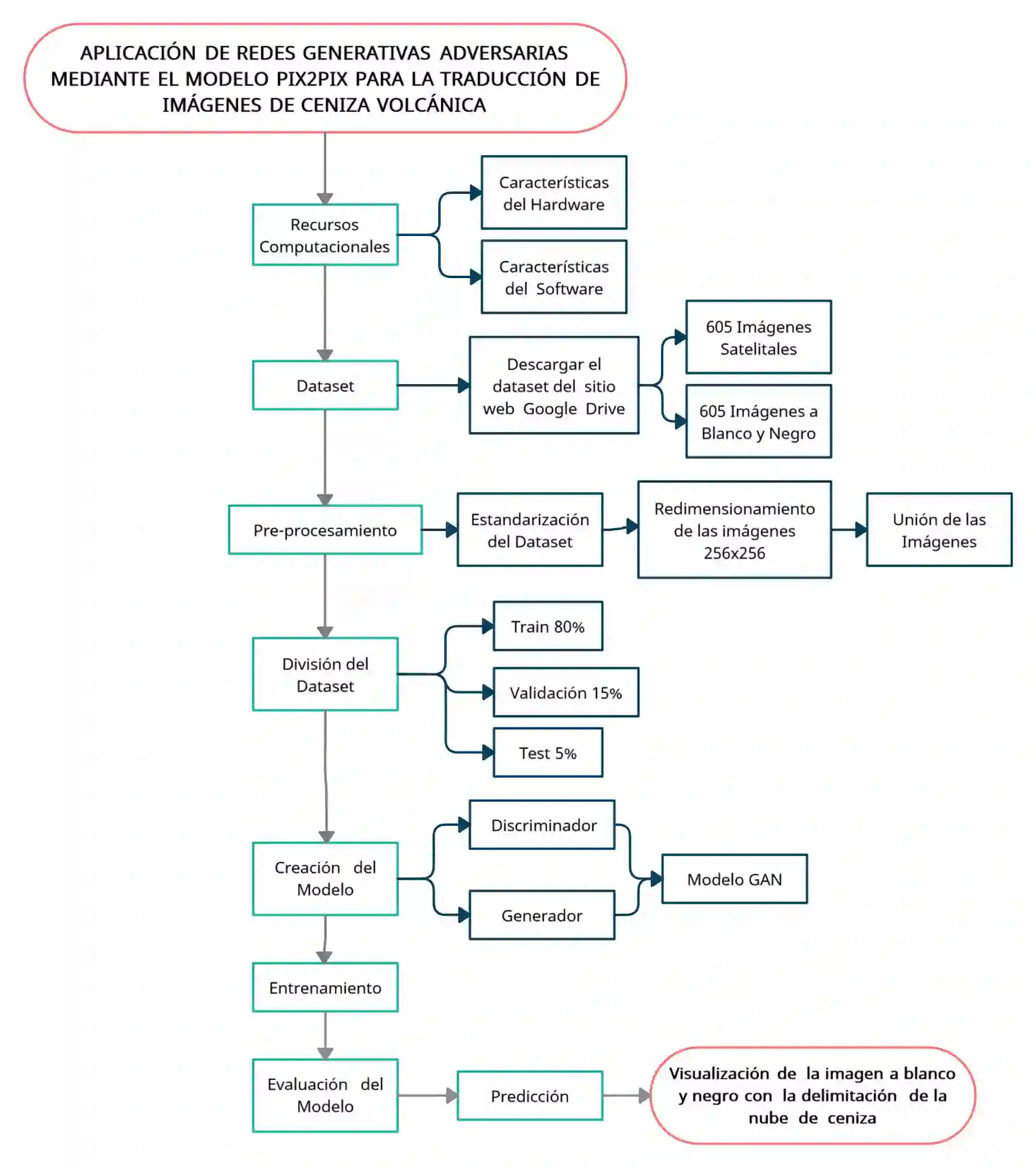
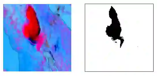
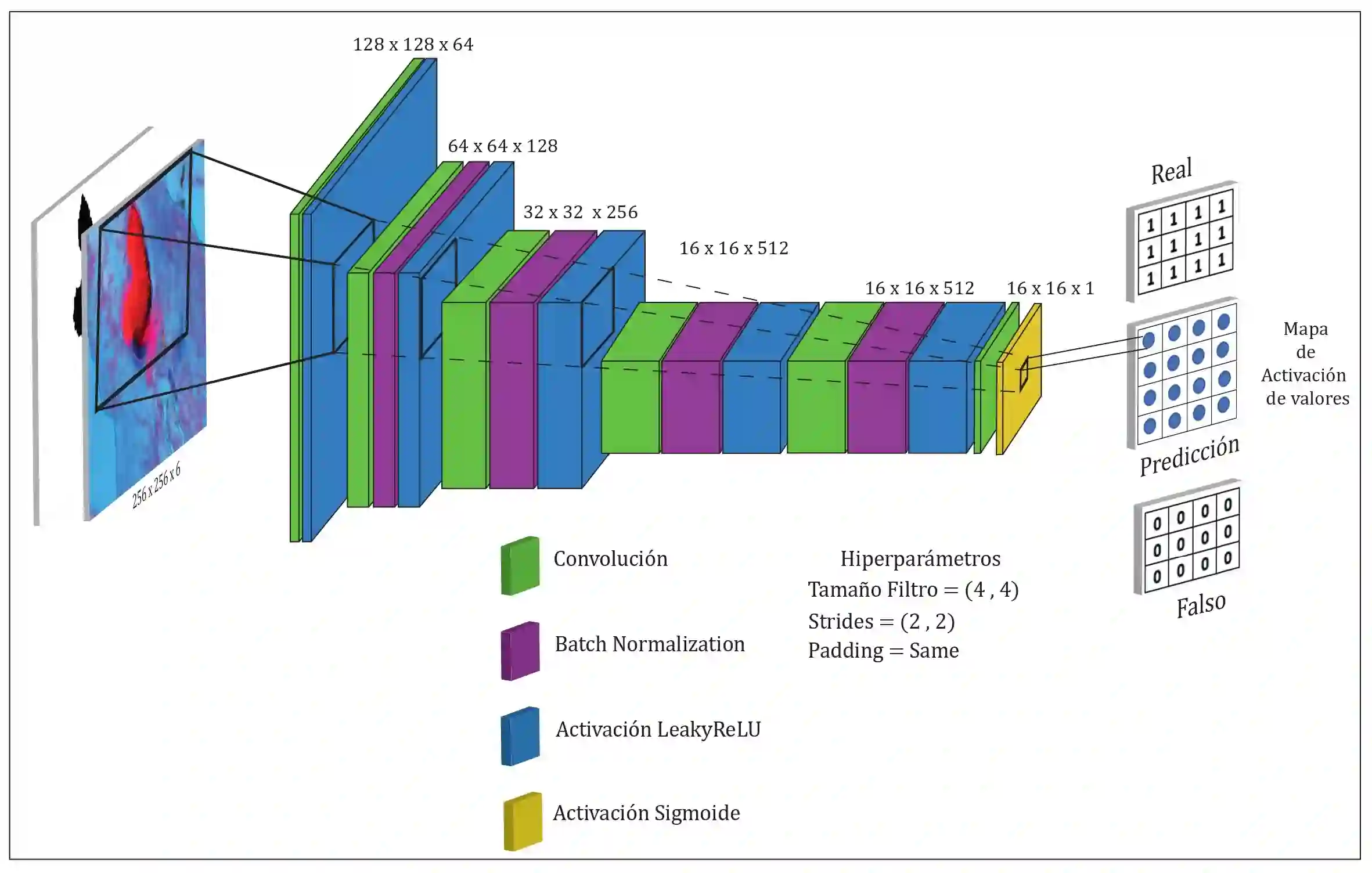
Volcanic eruptions emit ash that can be harmful to human health and cause damage to infrastructure, economic activities and the environment. The delimitation of ash clouds allows to know their behavior and dispersion, which helps in the prevention and mitigation of this phenomenon. Traditional methods take advantage of specialized software programs to process the bands or channels that compose the satellite images. However, their use is limited to experts and demands a lot of time and significant computational resources. In recent years, Artificial Intelligence has been a milestone in the computational treatment of complex problems in different areas. In particular, Deep Learning techniques allow automatic, fast and accurate processing of digital images. The present work proposes the use of the Pix2Pix model, a type of generative adversarial network that, once trained, learns the mapping of input images to output images. The architecture of such a network consisting of a generator and a discriminator provides the versatility needed to produce black and white ash cloud images from multispectral satellite images. The evaluation of the model, based on loss and accuracy plots, a confusion matrix, and visual inspection, indicates a satisfactory solution for accurate ash cloud delineation, applicable in any area of the world and becomes a useful tool in risk management.
翻译:火山喷发产生的火山灰对人类健康构成危害,并可能对基础设施、经济活动及环境造成破坏。火山灰云的划定有助于掌握其行为特征与扩散规律,从而为该现象的预防和减灾提供支持。传统方法依赖专业软件程序处理构成卫星影像的波段或通道,但其使用局限于专家群体,且耗时巨大、计算资源需求显著。近年来,人工智能已成为不同领域复杂问题计算处理的重要里程碑。其中,深度学习技术能够实现数字影像的自动、快速与精准处理。本研究提出采用Pix2Pix模型——一种生成式对抗网络——经过训练后,该模型能够学习从输入图像到输出图像的映射。该网络架构由生成器与判别器构成,为从多光谱卫星影像生成黑白火山灰云图像提供了所需的灵活性。基于损失值与准确率曲线、混淆矩阵及视觉检测的模型评估表明,该方法能够实现精准的火山灰云划定,适用于全球任何区域,并成为风险管理中的实用工具。