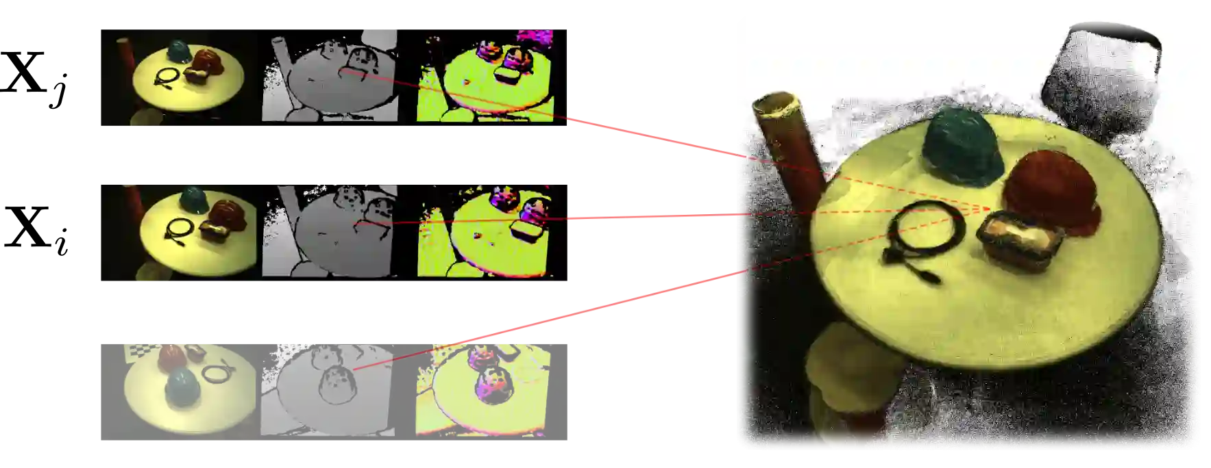
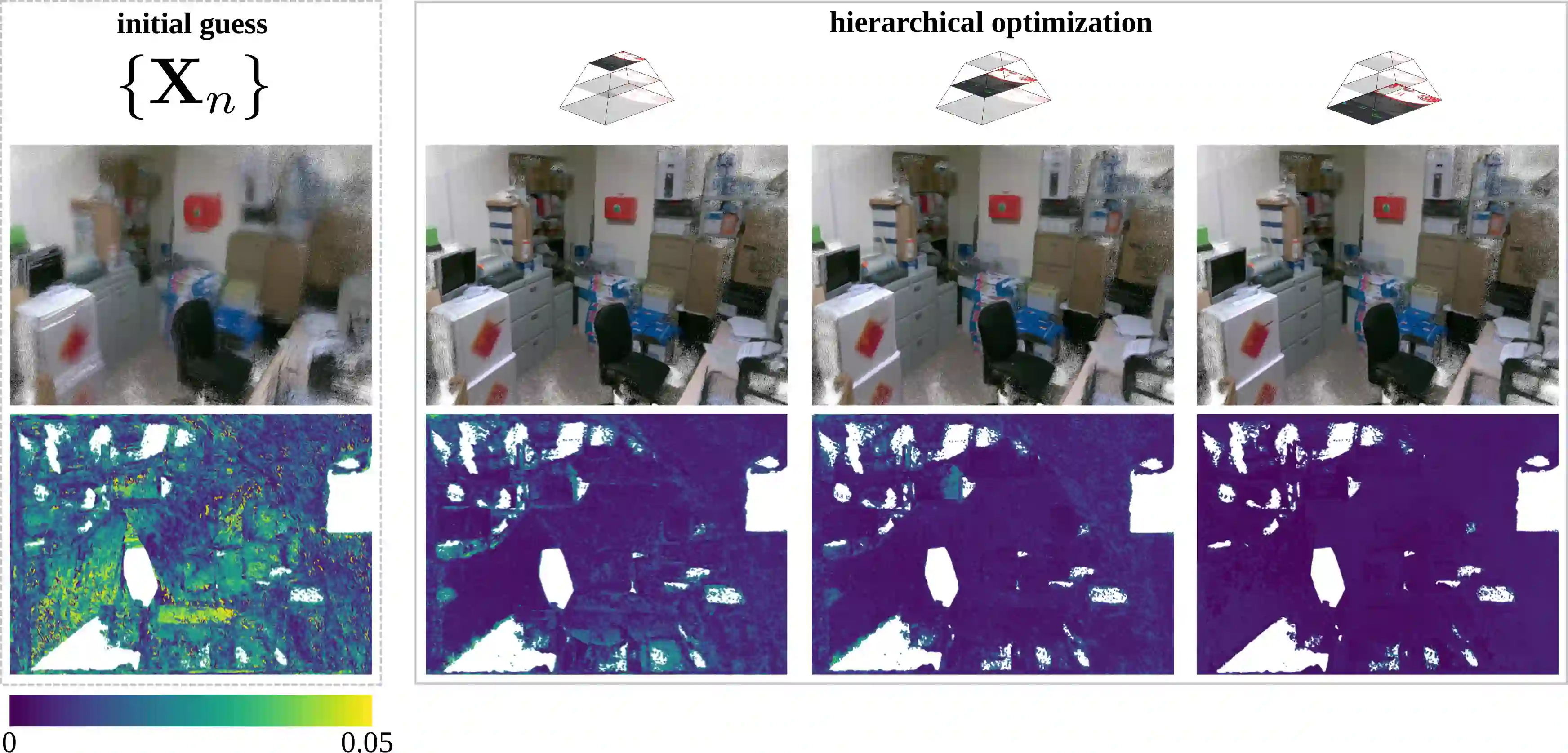
The joint optimization of the sensor trajectory and 3D map is a crucial characteristic of Simultaneous Localization and Mapping (SLAM) systems. To achieve this, the gold standard is Bundle Adjustment (BA). Modern 3D LiDARs now retain higher resolutions that enable the creation of point cloud images resembling those taken by conventional cameras. Nevertheless, the typical effective global refinement techniques employed for RGB-D sensors are not widely applied to LiDARs. This paper presents a novel BA photometric strategy that accounts for both RGB-D and LiDAR in the same way. Our work can be used on top of any SLAM/GNSS estimate to improve and refine the initial trajectory. We conducted different experiments using these two depth sensors on public benchmarks. Our results show that our system performs on par or better compared to other state-of-the-art ad-hoc SLAM/BA strategies, free from data association and without making assumptions about the environment. In addition, we present the benefit of jointly using RGB-D and LiDAR within our unified method. We finally release an open-source CUDA/C++ implementation.
翻译:传感器轨迹与三维地图的联合优化是同时定位与地图构建(SLAM)系统的关键特性。实现该优化的黄金标准是光束法平差(BA)。现代三维LiDAR已具备更高分辨率,能够生成与传统相机拍摄图像类似的点云图像。然而,常用于RGB-D传感器的有效全局优化技术并未广泛应用于LiDAR。本文提出一种新颖的光度BA策略,以统一方式处理RGB-D和LiDAR数据。该方法可叠加于任何SLAM/GNSS估计之上,用于改进和精化初始轨迹。我们利用这两种深度传感器在公开基准数据集上进行了多项实验。结果表明,本系统无需数据关联且不对环境做出假设,其性能可媲美或优于其他专门设计的先进SLAM/BA策略。此外,我们展示了在统一框架中联合使用RGB-D与LiDAR的优势。最后,我们开源了CUDA/C++实现方案。