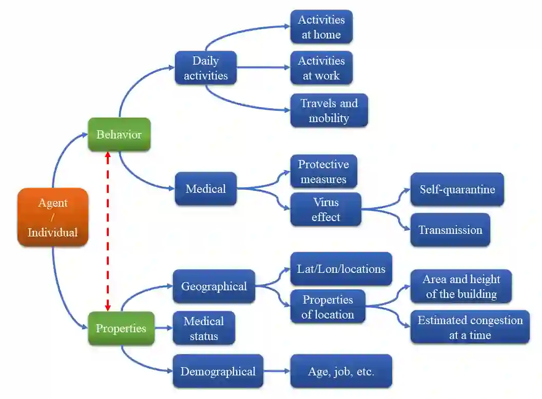
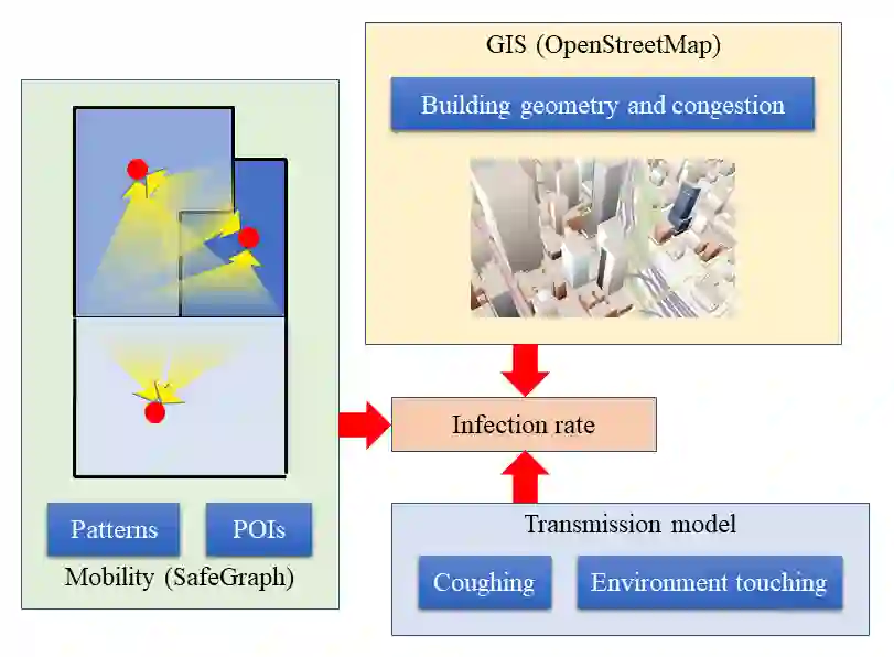
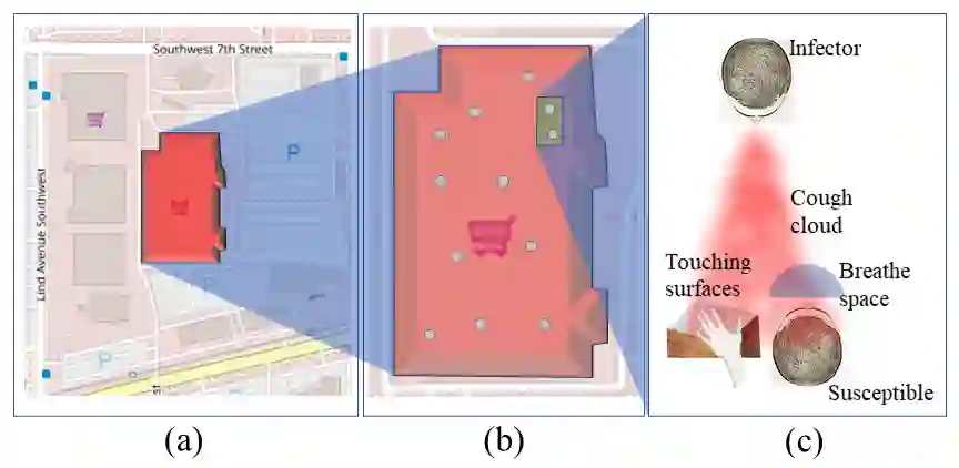
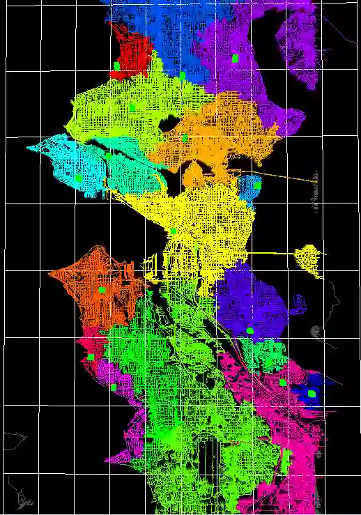
Our study presents an intermediate-level modeling approach that bridges the gap between complex Agent-Based Models (ABMs) and traditional compartmental models for infectious diseases. We introduce "super-agents" to simulate infection spread in cities, reducing computational complexity while retaining individual-level interactions. This approach leverages real-world mobility data and strategic geospatial tessellations for efficiency. Voronoi Diagram tessellations, based on specific street network locations, outperform standard Census Block Group tessellations, and a hybrid approach balances accuracy and efficiency. Benchmarking against existing ABMs highlights key optimizations. This research improves disease modeling in urban areas, aiding public health strategies in scenarios requiring geographic specificity and high computational efficiency.
翻译:本研究提出了一种介于复杂基于主体模型(ABMs)与传统传染病室室模型之间的中间层次建模方法。我们引入了"超级代理"来模拟城市中的感染传播,在降低计算复杂性的同时保留个体层面的交互。该方法利用真实移动数据与战略性地理空间网格划分以提高效率。基于特定街道网络位置的Voronoi图网格划分优于标准的人口普查区块组网格划分,而一种混合方法则能在准确性与效率之间取得平衡。与现有ABMs的基准测试突显了关键优化点。本研究改进了城市区域的疾病建模,有助于在需要地理特异性与高计算效率的场景中制定公共卫生策略。