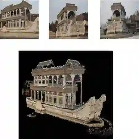
Three-dimensional (3D) reconstruction of ships is an important part of maritime monitoring, allowing improved visualization, inspection, and decision-making in real-world monitoring environments. However, most state-ofthe-art 3D reconstruction methods require multi-view supervision, annotated 3D ground truth, or are computationally intensive, making them impractical for real-time maritime deployment. In this work, we present an efficient pipeline for single-view 3D reconstruction of real ships by training entirely on synthetic data and requiring only a single view at inference. Our approach uses the Splatter Image network, which represents objects as sparse sets of 3D Gaussians for rapid and accurate reconstruction from single images. The model is first fine-tuned on synthetic ShapeNet vessels and further refined with a diverse custom dataset of 3D ships, bridging the domain gap between synthetic and real-world imagery. We integrate a state-of-the-art segmentation module based on YOLOv8 and custom preprocessing to ensure compatibility with the reconstruction network. Postprocessing steps include real-world scaling, centering, and orientation alignment, followed by georeferenced placement on an interactive web map using AIS metadata and homography-based mapping. Quantitative evaluation on synthetic validation data demonstrates strong reconstruction fidelity, while qualitative results on real maritime images from the ShipSG dataset confirm the potential for transfer to operational maritime settings. The final system provides interactive 3D inspection of real ships without requiring real-world 3D annotations. This pipeline provides an efficient, scalable solution for maritime monitoring and highlights a path toward real-time 3D ship visualization in practical applications. Interactive demo: https://dlr-mi.github.io/ship3d-demo/.
翻译:船舶三维重建是海上监测的重要组成部分,能够提升真实监测环境中的可视化、检测与决策能力。然而,当前最先进的三维重建方法大多需要多视角监督、标注的三维真值数据或计算开销巨大,难以在实际海上场景中实时部署。本研究提出一种高效的单视图真实船舶三维重建流程,该流程完全在合成数据上训练,且推理时仅需单张图像。我们的方法采用 Splatter Image 网络,该网络将物体表示为稀疏的三维高斯集合,从而能够从单张图像实现快速而准确的重建。模型首先在合成的 ShapeNet 船舶数据集上进行微调,并进一步使用多样化的自定义三维船舶数据集进行精炼,以弥合合成图像与真实图像之间的域差异。我们集成了基于 YOLOv8 的先进分割模块及自定义预处理步骤,以确保与重建网络的兼容性。后处理步骤包括真实世界尺度缩放、中心化与方向对齐,随后利用 AIS 元数据和基于单应性的映射,将重建结果地理配准至交互式网络地图上。在合成验证数据上的定量评估表明该方法具有出色的重建保真度,而在来自 ShipSG 数据集的真实海上图像上的定性结果则证实了其向实际海上作业环境迁移的潜力。最终系统无需真实世界的三维标注即可提供真实船舶的交互式三维检视。该流程为海上监测提供了一种高效、可扩展的解决方案,并为实际应用中的实时三维船舶可视化指明了方向。交互式演示:https://dlr-mi.github.io/ship3d-demo/。