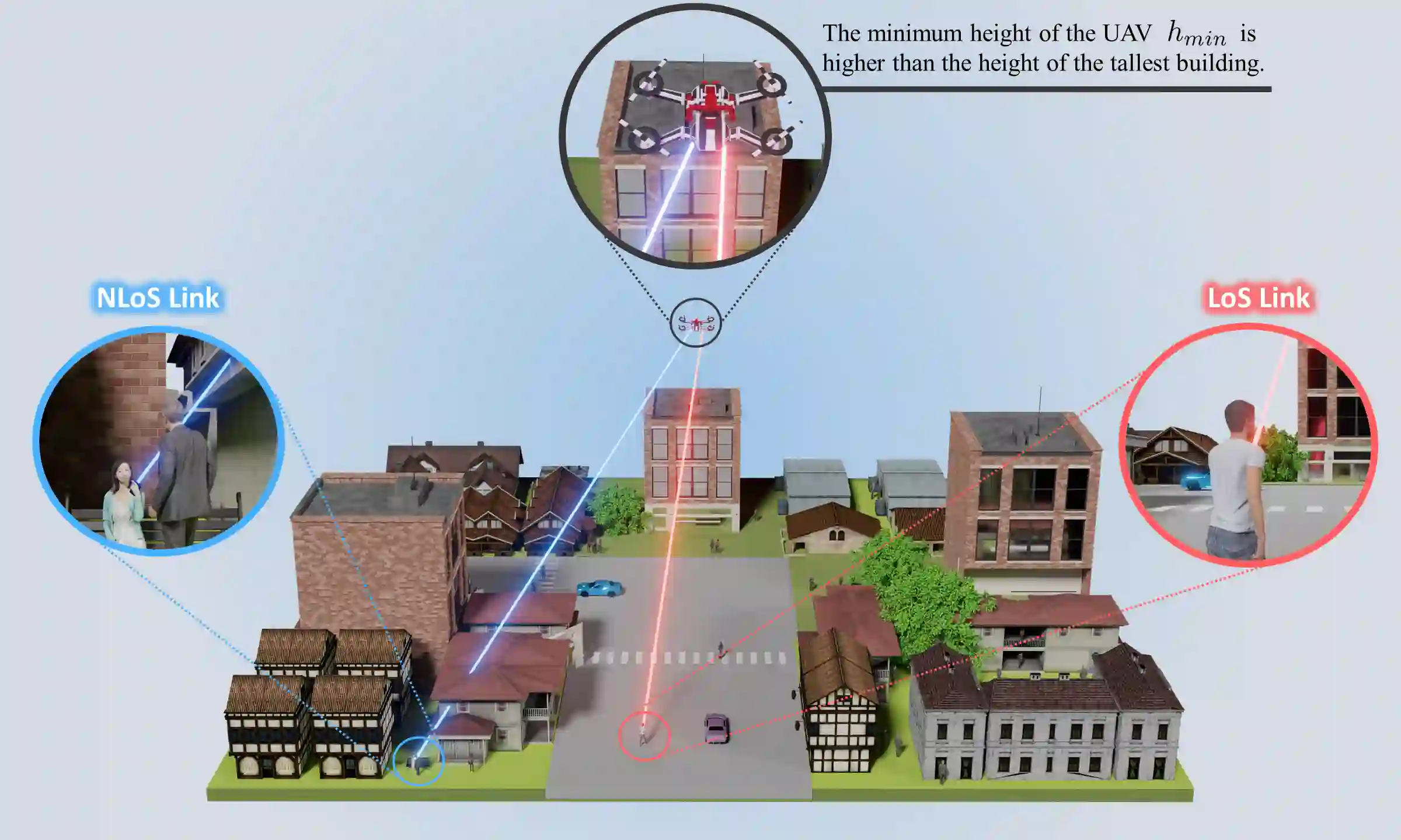
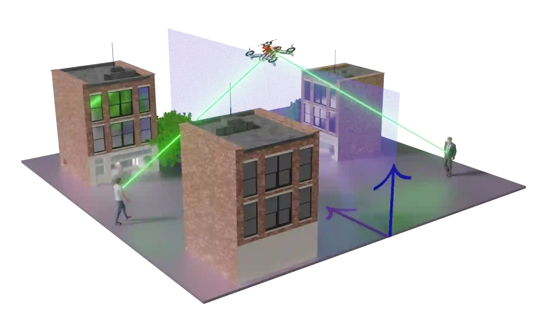
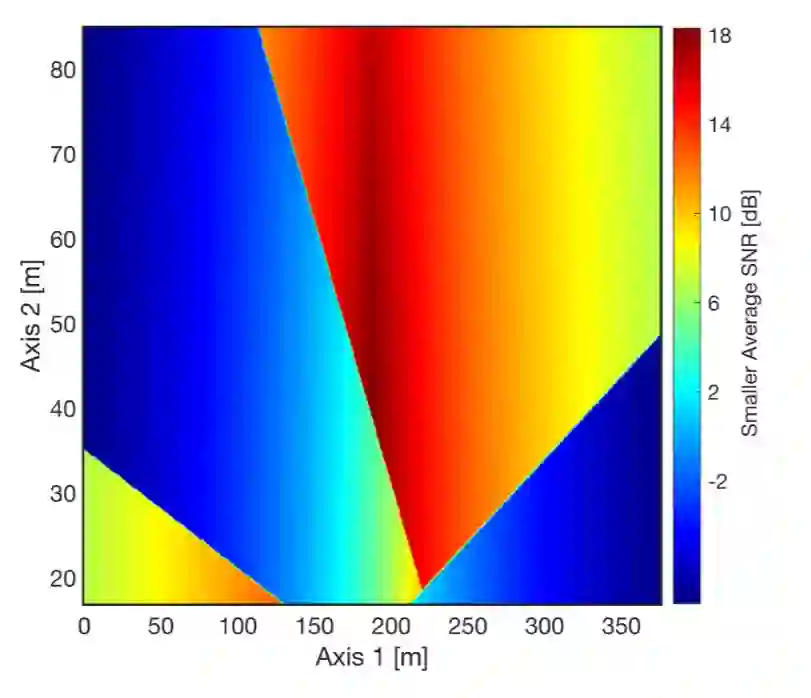
Deploying unmanned aerial vehicle (UAV) networks to provide coverage for outdoor users has attracted great attention during the last decade. However, outdoor coverage is challenging due to the high mobility of crowds and the diverse terrain configurations causing building blockage. Most studies use stochastic channel models to characterize the impact of building blockage on user performance and do not take into account terrain information. On the other hand, real-time search methods use terrain information, but they are only practical when a single UAV serves a single user.In this paper, we put forward two methods to avoid building blockage in a multi-user system by collecting prior terrain information and using real-time search.We proposed four algorithms related to the combinations of the above methods and their performances are evaluated and compared in different scenarios.By adjusting the height of the UAV based on terrain information collected before networking, the performance is significantly enhanced compared to the one when no terrain information is available.The algorithm based on real-time search further improves the coverage performance by avoiding the shadow of buildings. During the execution of the real-time search algorithm, the search distance is reduced using the collected terrain information.
翻译:在过去十年中,部署无人机网络为户外用户提供覆盖已引起广泛关注。然而,由于人群的高机动性以及导致建筑遮挡的多样化地形配置,户外覆盖面临挑战。大多数研究使用随机信道模型来表征建筑遮挡对用户性能的影响,并未考虑地形信息。另一方面,实时搜索方法虽利用地形信息,但仅适用于单架无人机服务单个用户的情况。本文提出两种方法,通过收集先验地形信息并利用实时搜索,在多用户系统中避免建筑遮挡。我们提出了与上述方法组合相关的四种算法,并在不同场景下评估和比较其性能。通过根据组网前收集的地形信息调整无人机高度,与无地形信息的情况相比,性能得到显著提升。基于实时搜索的算法通过避开建筑阴影进一步提高了覆盖性能。在执行实时搜索算法期间,利用收集的地形信息缩短了搜索距离。