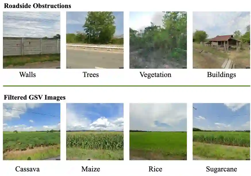
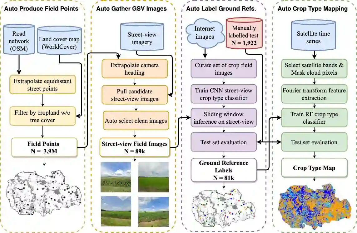
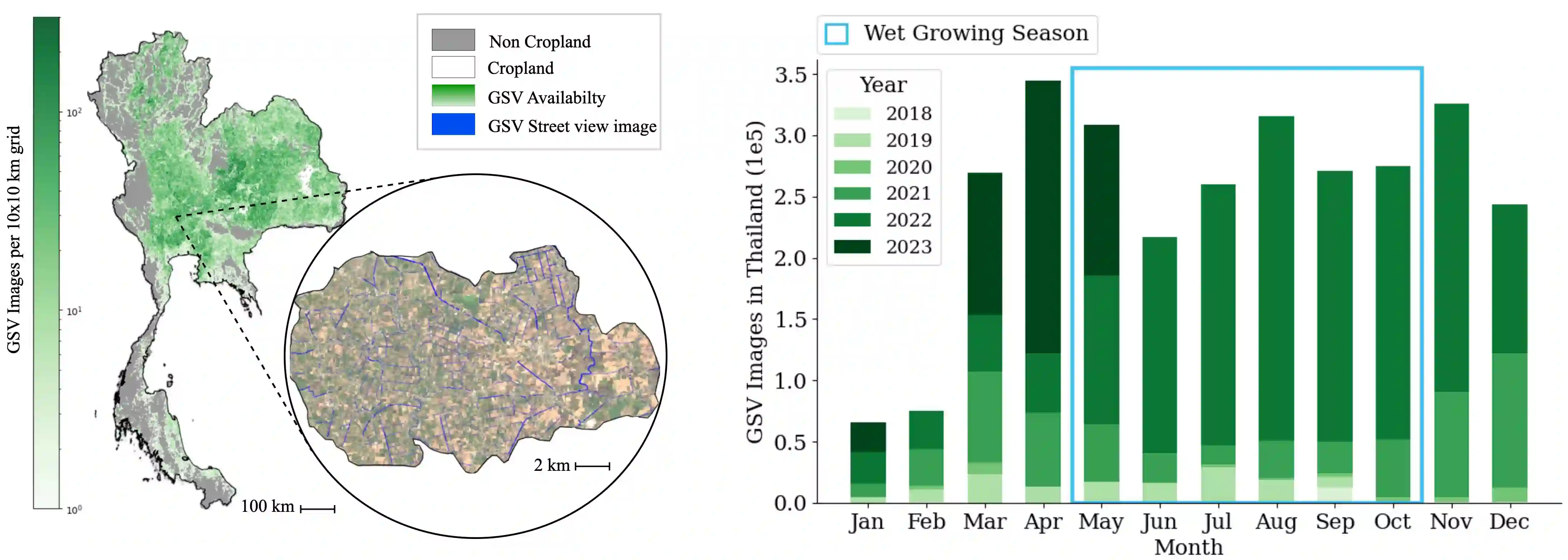
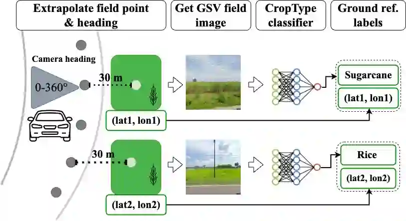
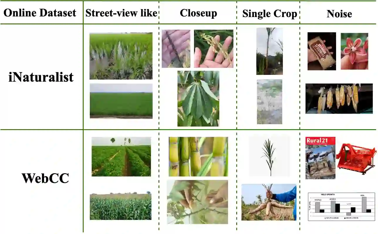
Accurate crop type maps are an essential source of information for monitoring yield progress at scale, projecting global crop production, and planning effective policies. To date, however, crop type maps remain challenging to create in low and middle-income countries due to a lack of ground truth labels for training machine learning models. Field surveys are the gold standard in terms of accuracy but require an often-prohibitively large amount of time, money, and statistical capacity. In recent years, street-level imagery, such as Google Street View, KartaView, and Mapillary, has become available around the world. Such imagery contains rich information about crop types grown at particular locations and times. In this work, we develop an automated system to generate crop type ground references using deep learning and Google Street View imagery. The method efficiently curates a set of street view images containing crop fields, trains a model to predict crop type by utilizing weakly-labelled images from disparate out-of-domain sources, and combines predicted labels with remote sensing time series to create a wall-to-wall crop type map. We show that, in Thailand, the resulting country-wide map of rice, cassava, maize, and sugarcane achieves an accuracy of 93%. We publicly release the first-ever crop type map for all of Thailand 2022 at 10m-resolution with no gaps. To our knowledge, this is the first time a 10m-resolution, multi-crop map has been created for any smallholder country. As the availability of roadside imagery expands, our pipeline provides a way to map crop types at scale around the globe, especially in underserved smallholder regions.
翻译:精确的作物类型地图是监测规模性产量进展、预测全球作物产量以及制定有效政策的重要信息来源。然而,由于缺乏用于训练机器学习模型的地面真实标签,中低收入国家的作物类型地图至今仍难以绘制。实地调查在准确性方面是黄金标准,但往往需要耗费大量时间、资金和统计能力,成本高昂。近年来,谷歌街景、KartaView和Mapillary等街道级影像已在全球范围内可用。此类影像包含特定地点和时间种植的作物类型的丰富信息。本研究开发了一套自动化系统,利用深度学习和谷歌街景影像生成作物类型地面参考数据。该方法高效整理了一组包含作物田地的街景图像,利用来自不同域外来源的弱标注图像训练模型预测作物类型,并将预测标签与遥感时间序列相结合,生成了全覆盖的作物类型地图。我们证明,在泰国,最终生成的全国范围水稻、木薯、玉米和甘蔗地图的准确率达到93%。我们公开发布了首个泰国全境2022年10米分辨率无间隙作物类型地图。据我们所知,这是首次为任何小农户国家创建10米分辨率多作物地图。随着路边影像的普及,本方法为全球范围内(尤其是服务不足的小农户地区)大规模绘制作物类型地图提供了途径。