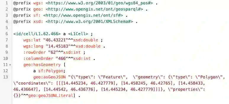
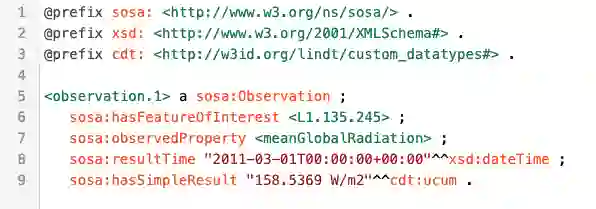
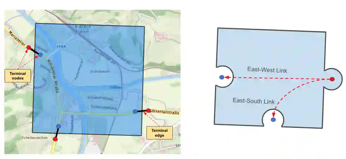
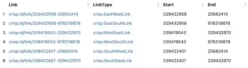
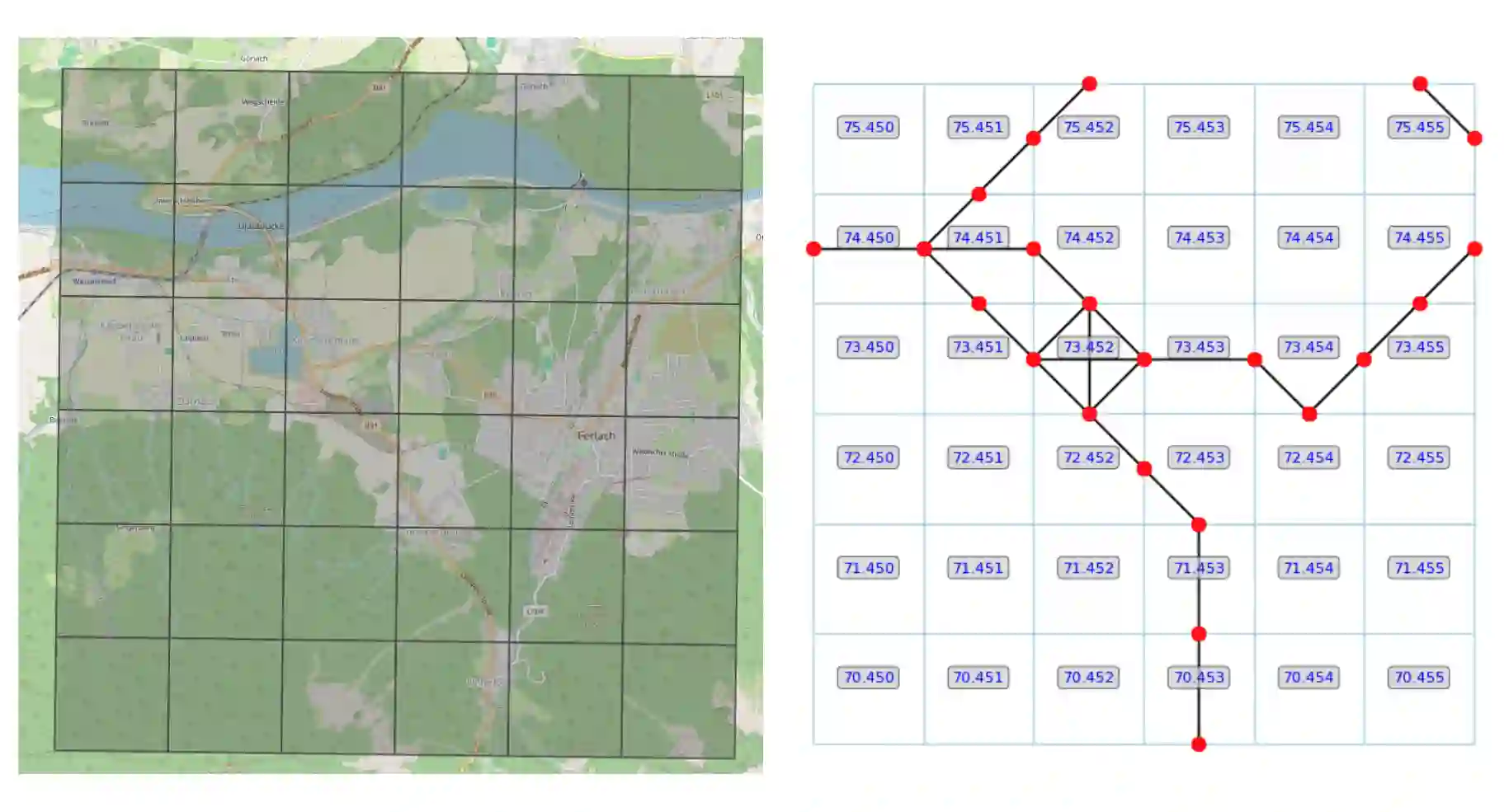
The Spatial Knowledge Graphs (SKG) are experiencing growing adoption as a means to model real-world entities, proving especially invaluable in domains like crisis management and urban planning. Considering that RDF specifications offer limited support for effectively managing spatial information, it's common practice to include text-based serializations of geometrical features, such as polygons and lines, as string literals in knowledge graphs. Consequently, Spatial Knowledge Graphs (SKGs) often rely on geo-enabled RDF Stores capable of parsing, interpreting, and indexing such serializations. In this paper, we leverage grid cells as the foundational element of SKGs and demonstrate how efficiently the spatial characteristics of real-world entities and their attributes can be encoded within knowledge graphs. Furthermore, we introduce a novel methodology for representing street networks in knowledge graphs, diverging from the conventional practice of individually capturing each street segment. Instead, our approach is based on tessellating the street network using grid cells and creating a simplified representation that could be utilized for various routing and navigation tasks, solely relying on RDF specifications.
翻译:空间知识图谱(SKG)作为建模现实世界实体的手段正获得日益广泛的应用,在危机管理和城市规划等领域尤其具有重要价值。鉴于RDF规范对空间信息管理的支持有限,通常将几何特征(如多边形和折线)的文本序列化表示作为字符串字面量纳入知识图谱。因此,空间知识图谱(SKG)往往依赖支持地理信息的RDF存储系统来解析、解释和索引此类序列化数据。本文以网格单元作为SKG的基础要素,论证了如何高效地将现实世界实体及其属性的空间特征编码至知识图谱中。此外,我们提出了一种在知识图谱中表示街道网络的新方法,该方法摒弃了传统上单独捕获每个街道段的做法,转而采用网格单元对街道网络进行镶嵌划分,创建出仅依赖RDF规范即可适用于各类路径规划与导航任务的简化表征。