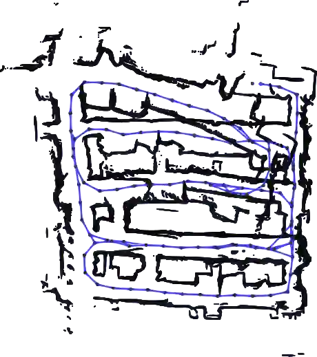
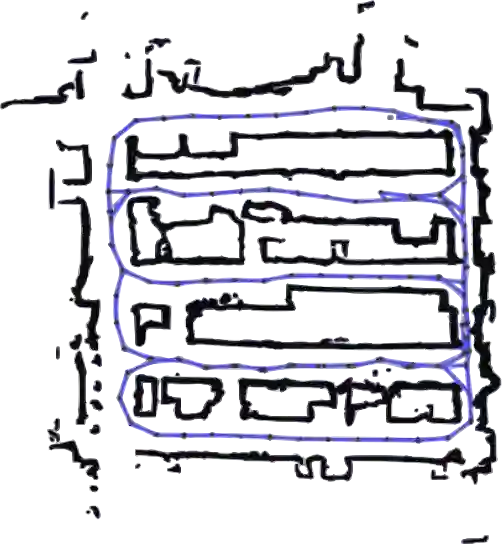
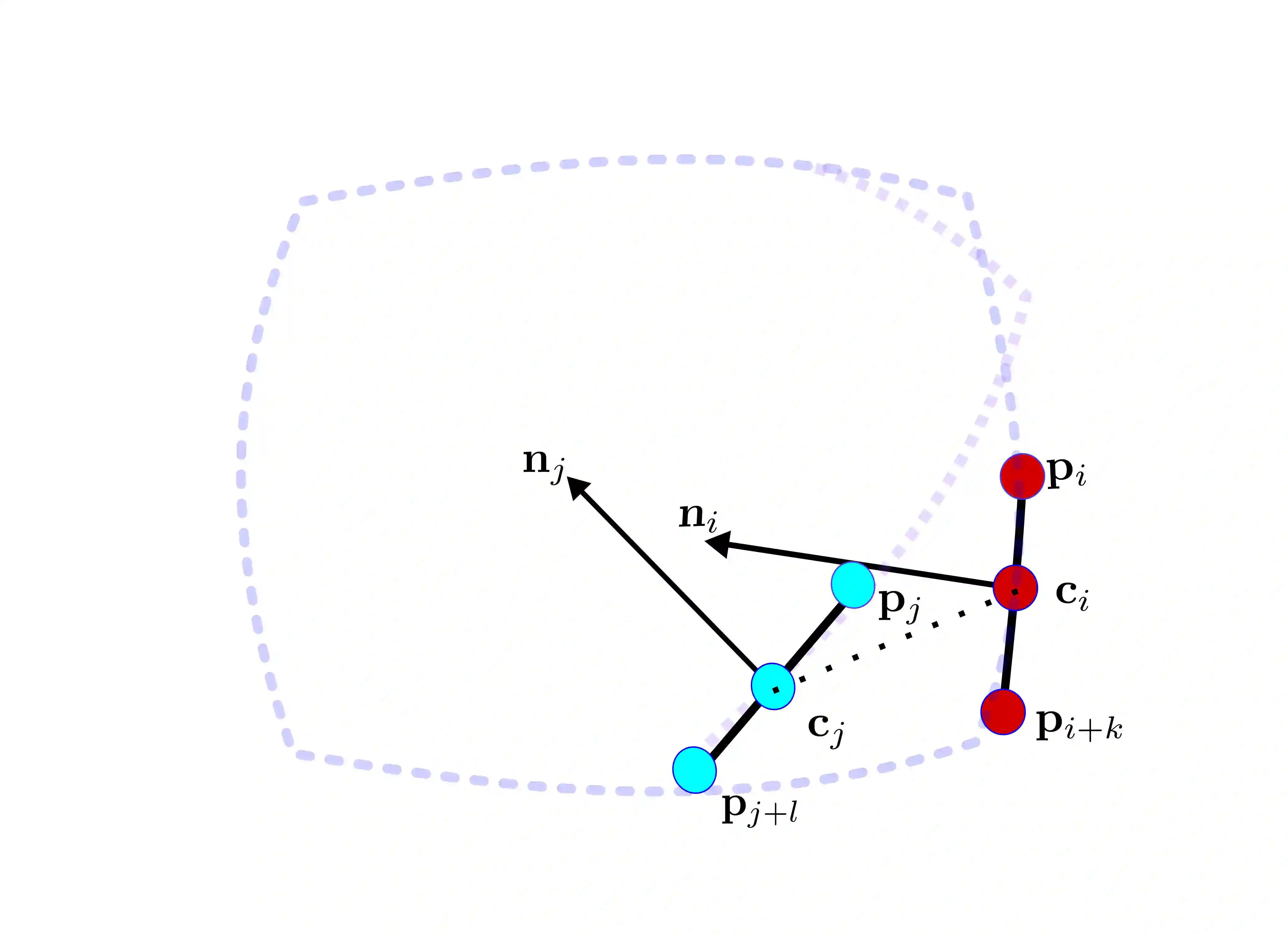
Most commercially available Light Detection and Ranging (LiDAR)s measure the distances along a 2D section of the environment by sequentially sampling the free range along directions centered at the sensor's origin. When the sensor moves during the acquisition, the measured ranges are affected by a phenomenon known as skewing, which appears as a distortion in the acquired scan. Skewing potentially affects all systems that rely on LiDAR data, however it could be compensated if the position of the sensor were known each time a single range is measured. Most methods to de-skew a LiDAR are based on external sensors such as IMU or wheel odometry, to estimate these intermediate LiDAR positions. In this paper we present a method that relies exclusively on range measurements to effectively estimate the robot velocities which are then used for de-skewing. Our approach is suitable for low frequency LiDAR where the skewing is more evident. It can be seamlessly integrated into existing pipelines, enhancing their performance at negligible computational cost. We validated the proposed method with statistical experiments characterizing different operating conditions
翻译:大多数商用光探测与测距(LiDAR)通过沿传感器原点为中心的各个方向顺序采样自由距离来测量环境二维截面的距离。当传感器在采集过程中移动时,测得距离会受到一种称为畸变的现象影响,表现为采集扫描中的扭曲变形。畸变可能影响所有依赖LiDAR数据的系统,但如果已知每次单一距离测量时的传感器位置,则可对这种畸变进行补偿。大多数LiDAR去畸变方法依赖外部传感器(如IMU或轮式里程计)来估计这些中间LiDAR位置。本文提出一种仅依赖距离测量值来有效估计机器人速度进而实现去畸变的方法。该方法适用于畸变更为显著的低频LiDAR,并能无缝集成到现有流程中,以微不足道的计算成本提升其性能。我们通过统计实验对表征不同运行条件的场景进行了方法验证。