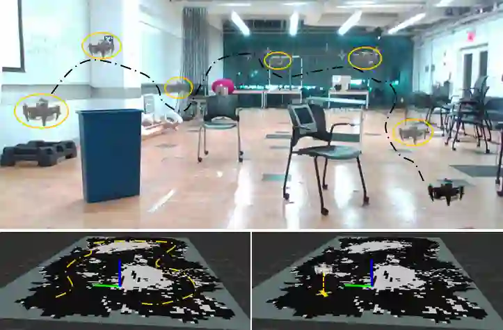
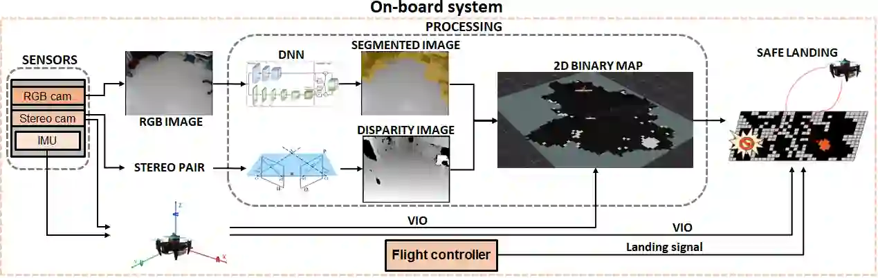
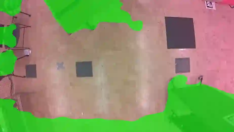
Autonomous identification and evaluation of safe landing zones are of paramount importance for ensuring the safety and effectiveness of aerial robots in the event of system failures, low battery, or the successful completion of specific tasks. In this paper, we present a novel approach for detection and assessment of potential landing sites for safe quadrotor landing. Our solution efficiently integrates 2D and 3D environmental information, eliminating the need for external aids such as GPS and computationally intensive elevation maps. The proposed pipeline combines semantic data derived from a Neural Network (NN), to extract environmental features, with geometric data obtained from a disparity map, to extract critical geometric attributes such as slope, flatness, and roughness. We define several cost metrics based on these attributes to evaluate safety, stability, and suitability of regions in the environments and identify the most suitable landing area. Our approach runs in real-time on quadrotors equipped with limited computational capabilities. Experimental results conducted in diverse environments demonstrate that the proposed method can effectively assess and identify suitable landing areas, enabling the safe and autonomous landing of a quadrotor.
翻译:自主识别并评估安全着陆区域,对于确保飞行机器人在系统故障、电量不足或特定任务成功完成时的安全性和有效性至关重要。本文提出了一种新颖方法,用于检测和评估四旋翼安全着陆的潜在地点。本方案高效整合了二维和三维环境信息,无需依赖GPS以及计算密集型高程图等外部辅助手段。所提出的流程结合了从神经网络(NN)中提取的语义数据(以获取环境特征)与从视差图中获取的几何数据(以提取坡度、平坦度和粗糙度等关键几何属性)。我们基于这些属性定义了若干成本度量,用于评估环境中各区域的安全性、稳定性和适宜性,从而锁定最佳着陆区域。本方法可在计算能力有限的四旋翼平台上实时运行。在多种环境中开展的实验结果表明,所提方法能够有效评估并识别适宜着陆区域,实现四旋翼的安全自主着陆。